CASE and CESSMA at the heart of French geography networks on Southeast Asia

Geography in Southeast Asia was first and foremost a geography of exploration, spurred on by colonial explorations such as the Pavie mission to the Indochinese frontier, whose observations[1], published in 11 volumes from the end of the 19th century onwards, helped build scientific knowledge and nourished universal geographies[2]. The Indochinese terrain first nurtured a colonial geography, then provided the foundations for so-called tropical geography.
The high densities of the Red River delta in Vietnam, while deltas elsewhere in the world were sometimes underpopulated, inspired Pierre Gourou in the 1930s to introduce a civilizational paradigm into geographical analyses. For him, the production of the delta's densely populated, monocultured rice-growing landscapes was the result of horizontal management techniques at family and village level, and vertical management techniques at kingdom level, stemming from the Chinese-influenced Vietnamese civilization, rather than from the natural conditions of the geographical environment or production techniques. The initiator of the "tropical geography" movement, which introduced these civilizational dimensions into geographical analysis, he had a major influence on 20th-century French geography, particularly that of Southeast Asia, the region from which his early work originated.
Jean Delvert, Professor at the Sorbonne-Paris IV and specialist in Southeast Asia, who trained many generations of geographers in a civilizational and cultural approach to geography, took up the idea of "agrarian civilization" in his work on the Cambodian peasant (thesis published in 1961). Difficult access to fieldwork subsequently reduced the scope of geography research in Southeast Asia, which then focused more on the insular region. The discipline has expanded and diversified again since the 1990s, but like other social science disciplines on Southeast Asia, still has a shortage of specialists compared to other regions of the world. Nevertheless, geography in Southeast Asia has played a major role in the discipline's epistemological reflections and contributed to its evolution. In the 1980s, it took part in the development of spatial analysis, which sought to identify spatial structures and their dynamics and to model them, around the latest universal geography coordinated by Roger Brunet (1995 for the volume including Southeast Asia coordinated by Michel Bruneau and Christian Taillard). From the late 1990s onwards, it produced innovative work on regional integration, at all scales, then on metropolization or on social and risk geography (the latter two approaches being little dealt with in the laboratories associated with Inalco, CASE and CESSMA).
The CASE was a leading research center for the geography of Southeast Asia, bringing together many geographers specializing in the region, including Inalco PhD students and teachers, around collective programs, before retirements and university recruitment dispersed researchers somewhat. Muriel Charras (†) for the insular part and Christian Taillard, for the continental part, both directors of research at the CNRS, were the driving forces behind the project. Authors of several contributions to the latest Universal Geography, they also led CASE's work on national atlases for Indonesia, Vietnam, Laos and Asia, as well as a multidisciplinary program on regional integration in East Asia. Analyzing the dynamics of integration between Southeast and Northeast Asia under the impact of globalization, the actors involved and the socio-spatial configurations produced, this program entitled "Nouvelles organisations régionales en Asie orientale (Norao)" resulted in the publication of two reference volumes entitled Nouvelles organisations régionales en Asie orientale, Intégrations régionales, and Nouvelles organisations régionales en Asie orientale, Identités régionales, 2004, Les Indes Savantes, coordinated respectively by Ch. Taillard and P. Pelletier.
.

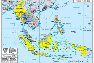
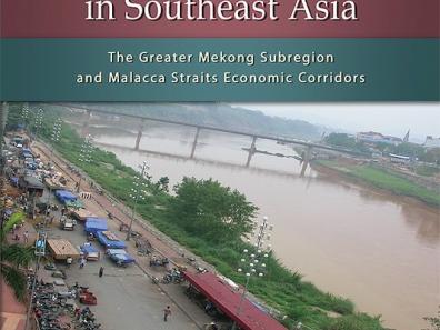
Work on regional integration then continued under the ANR Transiter (2008-2013), with a comparative focus on Southeast Asia and Central America. This ANR involved researchers from CASE and SEDET, the Paris-Denis-Diderot research team that has become CESSMA (IRD, UP, Inalco), as well as CEMCA, the research center of the Ministry of Europe and Foreign Affairs (MEAE) in Mexico. The scale of integration analyses changes with this program. The Norao program studied integration processes and transnational dynamics on the scale of large "supra-national" entities such as Asia's Pacific Rim, ASEAN[3] and continental or island Southeast Asia. This time, Transiter "zooms in" on more restricted spaces, the Greater Mekong region and the Strait of Malacca, and their "infra-national" transnational spaces created by the linking together of portions of territories in different countries. Produced by globalization in conjunction with, or in conflict with, national and ASEAN public policies, or those supported by international organizations such as the Asian Development Bank, these spaces adopt original forms such as corridors, cross-border metropolises and double cities. The results of this ANR were published at ISEAS in Singapore (N. Fau, M. Sirivanh and C. Taillard (Eds.), Regional integration in Southeast Asia, 2013, ISEAS, Singapore).

Globalization is also driving metropolization. The Norao program has shown that the main "nodes" structuring Asia's Pacific seaboard are cities, some of which, such as Hong Kong, Tokyo and Singapore, are part of the global metropolises as Saskia Sassen's work began to describe them in the early 1990s, while globalization is producing urban forms specific to Southeast Asia, as analyzed by T. Mc GEE with his theory of urban corridors combining urban and rural characteristics, or desa-kota in the terms he borrows from Malay (1989). Starting with CASE, CESSMA and the Norao group, expanded to include architects and urban planners and renewed with new generations of researchers, cities have been the focus of two successive research programs seeking to position Asia in relation to the scientific literature on metropolization. Taking the opposite approach to urban research, which at the time was essentially devoted to major metropolises, the first program looked at the dynamics of metropolization in the secondary cities of South-East Asia, which are also affected by the metropolization process in ways, means and actors that differ from those of the major metropolises, according to the program's conclusions. The second analyzes new urban forms and practices in Asia, essentially in the major Asian metropolises, at a time when Asia is turning its cities into symbols of modernity and developing urban production through projects. These programs have resulted in two publications by CNRS (M.Franck, Ch.Goldblum, Ch.Taillard (dir.), Territoires de l'urbain en Asie du Sud-Est, Métropolisations en mode mineur, 2012, CNRS Editions Alpha and M.Franck, T.Sanjuan (dir.), "Territoires de l'urbain en Asie : une nouvelle modernité?", 2015, CNRS Editions Alpha).

This journey through collective scientific programs obviously does not claim to be exhaustive of geography research on Southeast Asia. Nor does it exhaust the scientific production in geography at CASE or CESSMA, notably by IRD researchers on deltaic spaces, urban dynamics or maritime spaces, but it does highlight the logics of continuity and, from a more institutional angle, of networking and collaborations, notably between CASE and CESSMA.
To conclude, Southeast Asia features for the first time on the syllabus for the 2020 CAPES and agrégation geography competitions. This program has given rise to several publications, taking stock of the knowledge, approaches and themes developed in recent years in geography on Southeast Asia, and considerably enriching the availability of syntheses, hitherto few in number. While mastery of languages and civilizations is essential in geography, several former Inalco students and doctoral candidates are among the coordinators and contributors to the books (e.g. Céline Pierdet and Eric Sarraute (eds.) L'Asie du Sud-Est - Une géographie régionale, Ellipses, 576 p.) as well as tenured or part-time lecturers in Southeast Asian geography, members of CASE or CESSMA (For example, Nathalie Fau and Manuelle Franck (dir.), 2019, L'Asie du Sud-Est. Émergence d'une région, mutation des territoires, Armand Colin, 448 p.; Marion Sabrié and Raymond Woessner (dir.), 2019, L'Asie du Sud-Est, Atlande, 300 p.).
Manuelle Franck
Professor in the geography of Southeast Asia
Centre d'études en sciences sociales sur les mondes africains, américains et asiatiques (CESSMA), UMR 245
Urban and regional geography of Southeast Asia
Secondary cities in Indonesia and Southeast Asia
Regional integration and transnational dynamics in island Southeast Asia
_______________________________________
[1] For the Malay archipelago, Let's not forget the lesser-known missions from the very early 19th century that showed an interest in Insulinde under the Revolution, Consulate and Empire, with exploratory missions to the Lesser Sunda Islands and the missions of Brau de Saint Pol Lias (1870s) on behalf of the Société de Géographie to Sumatra and Malaysia in particular. We should also mention the creation of the Société des Colons Explorateurs (1876-1881), whose aim was to colonize and develop northern Sumatra. Note written by Jérôme Samuel, in reference to P. Labrousse's article, Brau de Saint-Pol Lias à Sumatra (1876-1881). Utopies coloniales et figures de l'explorateur, Archipel, n°77, 2009, p. 83-116.
[2] These multi-volume works regularly take stock of geographical knowledge throughout the world. The first Universal Geography was written by Malte Brun in the first third of the 19th century, the second by Elisée Reclus in the last quarter of the 19th century, the third was coordinated by Vidal de la Blache in the first third of the 20th century, the fourth by Roger Brunet in the last third of the 20th century.
[3] Association of South-East Asian Nations.